How long does it take to deploy across a district?
Most districts go live within 30 days. We map every school, inventory critical safety equipment, and publish evacuation routes to web, mobile, and print without requiring any IT installs at the school sites. Staff log in from a browser the same day they're trained.
Do teachers and staff need to install anything?
No. The same map runs on web, iOS, and Android, plus printable versions for binders and classroom walls. Staff open it like any web page. There is no app to install, no software to push, and no IT setup at the school. New staff get a link.
Is the platform secure for school-environment data?
Yes. InMapz is SOC 2 Type II and ISO 27001 certified. Floor plans and safety inventory data are encrypted at rest and in transit, with role-based access for administrators, staff, and first responders. Every change has an audit log.
Can first responders access the maps during an incident?
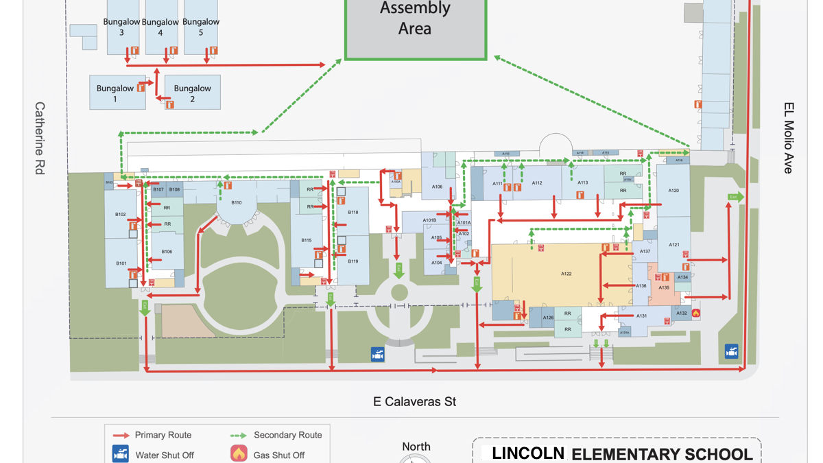
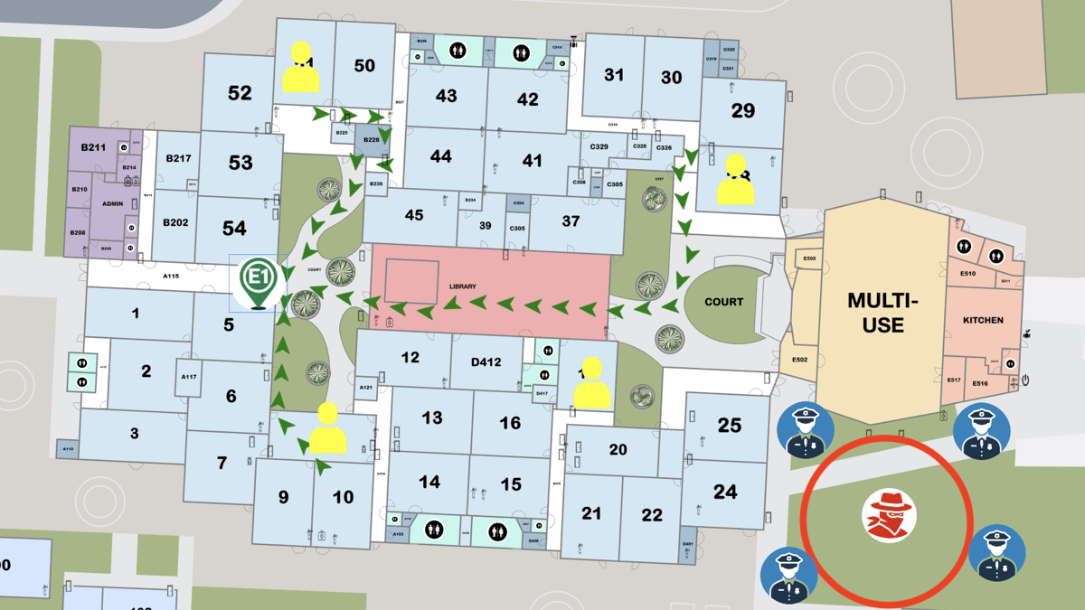
Yes. The Incident Command dashboard shares the live map and equipment locations with administrators, school resource officers, and external first responders during an event — so everyone sees the same picture instead of relying on paper printouts. Access can be pre-staged with local fire and police before an incident.
What happens when a school adds a building or remodels?
Send us the updated floor plan. We push the new map and re-routed evacuation paths to all devices within days. There are no new versions to install — every device pulls the current map. Posted aluminum signage can be re-issued separately on the same schedule.
Do you sell the egress map signs separately, or only with the platform?
Brushed-aluminum egress map signs are available with the platform subscription. They're weatherproof and anti-glare, sized for posting at exits, stairwells, elevators, and assembly points. The signs reflect the same routes published in the live system, so the wall and the phone never disagree.